field resources
manuals
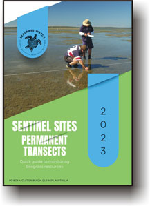
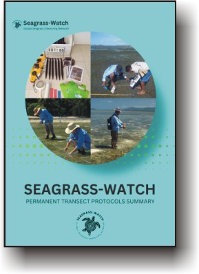
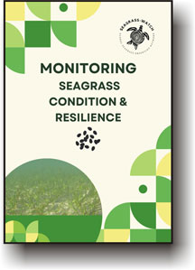
Global Seagrass Research Methods and Manuals. Percent Cover Standards along with Field Guides and booklets and other documents to help you monitor and research Global Seagrass
percent cover standards
Choose the cover standard that corresponds to your seagrass species and habitat.
field guides/booklets
Select your seagrass geographic bioregion, and download the relevant FIELD GUIDES, EXCEL SPREADSHEETS or select from the lists below.
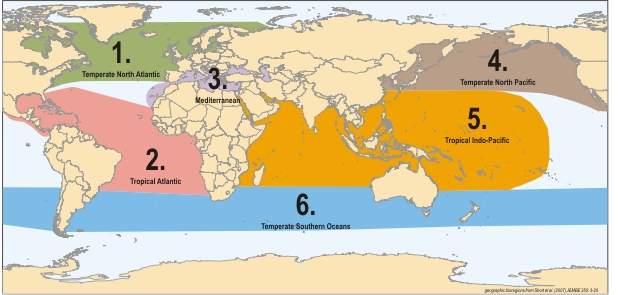
REGION/BIO REGION guides: Choose the guide that corresponds to your region/bio region
Bio Region
Region 1
Temperate North Atlantic (North Carolina, USA to Portugal)
Download items below
- Data Sheets
- Excel Spreadsheet
Region 2
Tropical Atlantic (including the Caribbean Sea, Gulf of Mexico, Bermuda, the Bahamas, and both tropical coasts of the Atlantic)
Download items below
- Data Sheets
- Excel Spreadsheet
Region 3
Mediterranean (including the Mediterranean Sea, the Black, Caspian and Aral Seas and northwest Africa)
Download items below
- Data Sheets
- Excel Spreadsheet
Region 4
Temperate North Pacific (Korea to Baja, Mexico)
Download items below
- Data Sheets
- Excel Spreadsheet
Region 5
Tropical Indo-Pacific (East Africa, south Asia and tropical Australia to the eastern Pacific)
Download items below
- Data Sheets
- Excel Spreadsheet
Region 6
Temperate Southern Oceans (New Zealand and temperate Australia, South America, and South Africa)
Download items below
- Data Sheets
- Excel Spreadsheet
datasheets
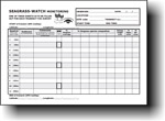
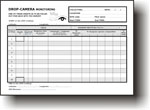
Choose the guide that corresponds to your seagrass monitoring activity
visual media
visual guides to assist with seagrass monitoring activity
Visual Guides
Please select the instructional video resource that corresponds with your seagrass field assessment activity. It is strongly recommended that you utilise the appropriate video guide for accurate and efficient execution of your field assessment.
These resources have been developed based on scientific research and will aid in ensuring consistency and standardization in your data collection methods.
We acknowledge that seagrass assessments play a crucial role in ecologically-based management and protection of marine habitats.
Therefore, it is imperative that your field assessments are conducted using the best practice techniques to provide scientifically robust and reliable data.
STEP 1: MATERIALS TO SET UP A DROP CAM KIT
Video detailing what is needed to set up a drop-camera kit
STEP 2: HOW TO ASSEMBLE A COLLAPSIBLE FRAME
Video detailing how to assemble a collapsible frame.
Thanks to Marine Research Foundation (www.mrf-asia.org) for assistance with imagery and instructions
STEP 3: HOW TO LINK SMART DEVICES WITH GoPro
Video detailing how to set up link between GoPro and Smart device
STEP 4: HOW TO ASSEMBLE DROP-CAMERA
Video detailing how to assemble a drop-camera frame using GoPro
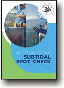
STEP 5: HOW TO CONDUCT SUBTIDAL SPOT-CHECKS
Video detailing how to conduct subtidal spot-checks using drop-camera
STEP 6: HOW TO AVOID BAD DROPS
Video detailing how to get the best out of your subtidal spot-checks
STEP 7: HOW TO USE A VAN VEEN GRAB
Video detailing how to use a Van Veen Grab
HOW TO CONDUCT SUBTIDAL SPOT-CHECKS
Video detailing how to conduct subtidal spot-checks using drop-camera
HOW TO AVOID BAD DROPS
Video detailing how to get the best out of your subtidal spot-checks
HOW TO CONDUCT INTERTIDAL SPOT-CHECK
Video detailing how conduct intertidal spot-checks
HOW TO CONDUCT PHOTO TRANSECTS
Video detailing how conduct photo transects
data entry
Once you have monitored your Seagrass-Watch site, you can now enter the data collected into a downloadable Microsoft Excel spreadsheet and submit via email. To enter and submit data, follow the following steps:
Select your seagrass geographic bioregion. Click on your region below to download the relevant web data entry spreadsheet

Region 1: Temperate North Atlantic (North Carolina, USA to Portugal)
Region 2: Tropical Atlantic (including the Caribbean Sea, Gulf of Mexico, Bermuda, the Bahamas, and both tropical coasts of the Atlantic)
Region 3: Mediterranean (including the Mediterranean Sea, the Black, Caspian and Aral Seas and northwest Africa)
Region 4: Temperate North Pacific (Korea to Baja, Mexico)
Region 5: Tropical Indo-Pacific (East Africa, south Asia and tropical Australia to the eastern Pacific)
Region 6: Temperate Southern Oceans (New Zealand and temperate Australia, South America, and South Africa)
Save the spreadsheet file to your computer before you begin data entry. We suggest changing the file name to the site code and the sampling date.
For example, if the site was Burrum Heads 1, and it was sampled on 09 February 2019 then the filename would be “BH1_09Feb19.xls”
The spreadsheets are a similar layout to the standard datasheets. Each transect has it’s own worksheet. To select the appropriate worksheet, click on the tab at the bottom
To enter data, select each cell with your mouse. You can jump between cells by using the TAB button on your keyboard.
First enter the name of the observers and the sampling date.
Enter the location and site code.
For the above example, the location is “Burrum Heads” and the site code is “BH1”.
Seagrass-Watch site codes are unique. It is important to request a site code from Seagrass-Watch HQ before establishing a new site. This will ensure your data can be integrated into the program and to prevent confusion in future.
Enter the time you started sampling the transect and the time you finished.
Times are entered at 24 hr with the hour separated from the minutes by a colon.
For example. if the time was half past one in the afternoon, the time entered would be “13:30”.
If you had a GPS (Global Positioning System) at the monitoring site, enter the latitude and longitude of start of the transect
Enter the data for each quadrat
Sediment: enter by the dominant grain size first, separating sediment categories by a forward slash.
- For example, if the quadrat was predominantly mud with some sand, then the data would be entered as “Mud/Sand”. Please do not use abbreviations “M/S” when entering into the spreadsheet.
Comments: Enter information (including counts) of any features which may be of interest.
- For example, “sea cucumbers (x2), sea urchin (x1), evidence of turtle cropping”
Photograph: type in “True” if you took a photo of the quadrat
% cover: enter the total percent cover of seagrass within the quadrat
% cover by species: enter the percentage cover that each species contributes to the total cover
CR = Cymodocea rotundata
CS = Cymodocea serrulata
EA = Enhalus acoroides
HC = Halophila capricorni
HD = Halophila decipiens
HM = Halophila minor
HO = Halophila ovalis
HP = Halodule pinifolia
HS = Halophila spinulosa
HT = Halophila tricostata
HU = Halodule uninervis
SI = Syringodium isoetifolium
TC = Thalassodendron ciliatum
TH = Thalassia hemprichii
ZM = Zostera muelleri
Canopy: enter the three canopy heights of the dominant strap leaf species (the average will calculate automatically)
% Algae: enter the percent cover of maco-algae in the quadrat. Macro-algae are seaweeds that are not attached to seagrass leaves and may even overlie the seagrass shoots. The combined seagrass and algae cover may be greater than 100%.
Epi %: Enter the percentage cover of epiphytes on the total seagrass leaves.
If you had a GPS (Global Positioning System) at the monitoring site, enter the latitude and longitude of end of the transect
Enter any general comments about the transect or site
Repeat steps 5 to 10 for the remaining transects
Ensure your file is securely saved
Submit a copy of the excel file via internet to Seagrass-Watch HQ admin@seagrasswatch.org
Quadrat & Miscellaneous images can be submitted via yousendit/Dropbox etc or on CD
- Quadrat photos must be of the highest quality digital images possible for camera used. Please note, we require quadrat photos to be taken at every quadrat (0m-50m) along each transect.
- Site & people photos (digital images are preferred) etc be of the highest quality possible for the camera used
Mail original datasheets and herbarium voucher specimens ( if collected) to
Seagrass-Watch HQ
PO BOX 4
CLIFTON BEACH, QLD 4879
AUSTRALIA

Select your seagrass geographic bioregion. Click on your region below to download the relevant web data entry spreadsheet
Region 1: Temperate North Atlantic (North Carolina, USA to Portugal)
Region 2: Tropical Atlantic (including the Caribbean Sea, Gulf of Mexico, Bermuda, the Bahamas, and both tropical coasts of the Atlantic)
Region 3: Mediterranean (including the Mediterranean Sea, the Black, Caspian and Aral Seas and northwest Africa)
Region 4: Temperate North Pacific (Korea to Baja, Mexico)
Region 5: Tropical Indo-Pacific (East Africa, south Asia and tropical Australia to the eastern Pacific)
Region 6: Temperate Southern Oceans (New Zealand and temperate Australia, South America, and South Africa)
Save the spreadsheet file to your computer before you begin data entry. We suggest changing the file name to the site code and the sampling date.
For example, if the site was Burrum Heads 1, and it was sampled on 09 February 2019 then the filename would be “BH1_09Feb19.xls”
The spreadsheets are a similar layout to the standard datasheets. Each transect has it’s own worksheet. To select the appropriate worksheet, click on the tab at the bottom
To enter data, select each cell with your mouse. You can jump between cells by using the TAB button on your keyboard.
First enter the name of the observers and the sampling date.
Enter the location and site code.
For the above example, the location is “Burrum Heads” and the site code is “BH1”.
Seagrass-Watch site codes are unique. It is important to request a site code from Seagrass-Watch HQ before establishing a new site. This will ensure your data can be integrated into the program and to prevent confusion in future.
Enter the time you started sampling the transect and the time you finished.
Times are entered at 24 hr with the hour separated from the minutes by a colon.
For example. if the time was half past one in the afternoon, the time entered would be “13:30”.
If you had a GPS (Global Positioning System) at the monitoring site, enter the latitude and longitude of start of the transect
Enter the data for each quadrat
Sediment: enter by the dominant grain size first, separating sediment categories by a forward slash.
- For example, if the quadrat was predominantly mud with some sand, then the data would be entered as “Mud/Sand”. Please do not use abbreviations “M/S” when entering into the spreadsheet.
Comments: Enter information (including counts) of any features which may be of interest.
- For example, “sea cucumbers (x2), sea urchin (x1), evidence of turtle cropping”
Photograph: type in “True” if you took a photo of the quadrat
% cover: enter the total percent cover of seagrass within the quadrat
% cover by species: enter the percentage cover that each species contributes to the total cover
CR = Cymodocea rotundata
CS = Cymodocea serrulata
EA = Enhalus acoroides
HC = Halophila capricorni
HD = Halophila decipiens
HM = Halophila minor
HO = Halophila ovalis
HP = Halodule pinifolia
HS = Halophila spinulosa
HT = Halophila tricostata
HU = Halodule uninervis
SI = Syringodium isoetifolium
TC = Thalassodendron ciliatum
TH = Thalassia hemprichii
ZM = Zostera muelleri
Canopy: enter the three canopy heights of the dominant strap leaf species (the average will calculate automatically)
% Algae: enter the percent cover of maco-algae in the quadrat. Macro-algae are seaweeds that are not attached to seagrass leaves and may even overlie the seagrass shoots. The combined seagrass and algae cover may be greater than 100%.
Epi %: Enter the percentage cover of epiphytes on the total seagrass leaves.
If you had a GPS (Global Positioning System) at the monitoring site, enter the latitude and longitude of end of the transect
Enter any general comments about the transect or site
Repeat steps 5 to 10 for the remaining transects
Ensure your file is securely saved
Submit a copy of the excel file via internet to Seagrass-Watch HQ (hq@seagrasswatch.org/admin@seagrasswatch.org)
Quadrat & Miscellaneous images can be submitted via yousendit/Dropbox etc or on CD
- Quadrat photos must be of the highest quality digital images possible for camera used. Please note, we require quadrat photos to be taken at every quadrat (0m-50m) along each transect.
- Site & people photos (digital images are preferred) etc be of the highest quality possible for the camera used
Mail original datasheets and herbarium voucher specimens ( if collected) to
Seagrass-Watch HQ
PO BOX 4
CLIFTON BEACH, QLD 4879
AUSTRALIA


