Cape York
Cape York
Cape York Peninsula is the northernmost extremity of Australia. From its tip at Cape York it extends southward in Queensland for about 800 km, widening to its base, which spans 650 km from Cairns (east) to the Gilbert River (west). The largest rivers empty into the Gulf of Carpentaria on the west, however there are several significant catchments which empty into the GBR. Major catchments of the region include the Macmillian, Olive, Pascoe, Lockhart, Stewart, Normanby, Jeannie, and Annan Rivers.
The region has a monsoonal climate with distinct wet and dry seasons with mean annual rainfall ranging from 1715 mm (Starke region) to 2159 mm (Lockhart River airport). Most rain falls between December and April. Mean daily air temperatures in the area range between 19.2 – 32.1°C. The prevailing winds are from the south east and persist throughout the year1.
Cape York Peninsula is an area of exceptional conservation value and has cultural value of great significance to both Indigenous and non-Indigenous communities. The majority of the land is relatively undeveloped, therefore water entering the GBR lagoon is perceived to be of a high quality. Cattle station leases occupy about 52 per cent of the total area, mostly located in central Cape York Peninsula but only around 33 per cent are active leases. Indigenous land comprises about 22 percent, with a significant area of the West coast being held under Native title and other areas being under native title claim. The remainder is mostly declared as National Park including joint management areas with local traditional owners or under other conservation tenures e.g. nature refuges, conservation areas, wildlife reserves. Mining, agriculture, and commercial and recreational fishing are the major economic activities. All these activities have the potential to expand in this region and with this expansion the risk of increased pollutants.
Extensive seagrass meadows are present in the GBRWHA waters of the Cape York NRM region. The seagrass historical baseline for the region was established in October-November 19842, when the nearshore seagrasses (shallower than 15m depth) were mapped as part of a multi year mapping project for the entire Queensland coast3. Initial mapping results from the Cape York region were first published in 1985, however in 2001, this data was entered into a relational database, validated and migrated to GIS format4. To complement the nearshore mapping, the seagrass historical baseline for deeper water (15m and deeper) seagrass meadows was established in November 1994 (south of Cape Weymouth) and November 1998 (north of Cape Weymouth)5.
Since the historical baselines, there have been several issued focused fine-scale mapping surveys and the establishment of monitoring sites for the MMP. Seagrass meadows have been found from intertidal regions to depths of 61m near Lizard Island5. Approximately 1,887 km2 of seagrass meadows have been mapped in the inshore waters of the Cape York region to 15m bMSL6,7,8,9,10,11,12 and an additional 10,878 km2 in offshore waters (>15m depth)6.
Approximately 60 percent of the mapped seagrass area in the shallow waters (<15m) of the GBRWHA occurs in the Cape York NRM (McKenzie et al. 2010c). Seagrass meadows in the Cape York region were characterized by high diversity and relatively small total biomass3.
Fifteen species of seagrass have been identified in the region13,2,3,14: Enhalus acoroides, Halodule pinifolia, Halodule uninervis, Halophila capricorni, Halophila decipiens, Halophila minor, Halophila ovalis, Halophila spinulosa, Halophila tricostata, Cymodocea rotundata, Cymodocea serrulata, Syringodium isoetifolium, Thalassia hemprichii, Thalassodendron ciliatum and Zostera muelleri ssp. capricorni. Areas notable as species rich include Barrow Point to Murdoch Point (12 species), Flinders Island and Princess Charlotte Bay (9 species), Weymouth Bay, Cape Direction, Murdoch Point - Lookout Point and Bedford Bay - Cedar Bay (8 species) and Escape River Margaret Bay, Bathurst Bay, Ninian River and Cape Flattery (7 species).
Halodule uninervis and Halophila ovalis are the most common species in coastal intertidal areas. Cymodocea serrulata and Syringodium isoetifolium are found in shallow subtidal areas that are sheltered from the south-east winds in a variety of habitats including estuaries and muddy bays and reef tops2,3.
Subtidal meadows of Halophila ovalis and Halophila spinulosa are also quite extensive3. Species common on coral reef platforms include Thalassia hemprichii and Cymodocea rotundata, generally around islands and on vegetated cays15. Enhalus acoroides is usually found as small isolated patches in sheltered embayments16,17. Sites that have been revisited since the broadscale surveys in the mid 1980s show that seagrasses generally occurred in similar areas but when surveyed at a finer scale were more extensive15.
Seagrasses in the deeper waters (>15m) have been assessed twice; once between 1994 and 19995 and again between 2003 and 200618. The modelled distribution of seagrass species for both time periods shows spatial discontinuities in deep water seagrass meadows along the north-south axis with a low probability of seagrass being present north of Princess Charlotte Bay and extensive seagrass areas in the south of the region extending out from the coast in the Lizard Island region19,5. Halophila ovalis, Halophila spinulosa, Halophila tricostata, Halophila decipiens and Halophila capricorni dominated the meadows in both surveys. The distribution of deepwater seagrasses appears to be mainly influenced by water clarity and a combination of propagule dispersal, nutrient supply, and current stress. Unfortunately monitoring in the deeper waters is beyond the scope of the MMP funds and only intertidal reef and coastal seagrass habitats are currently monitored.
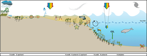
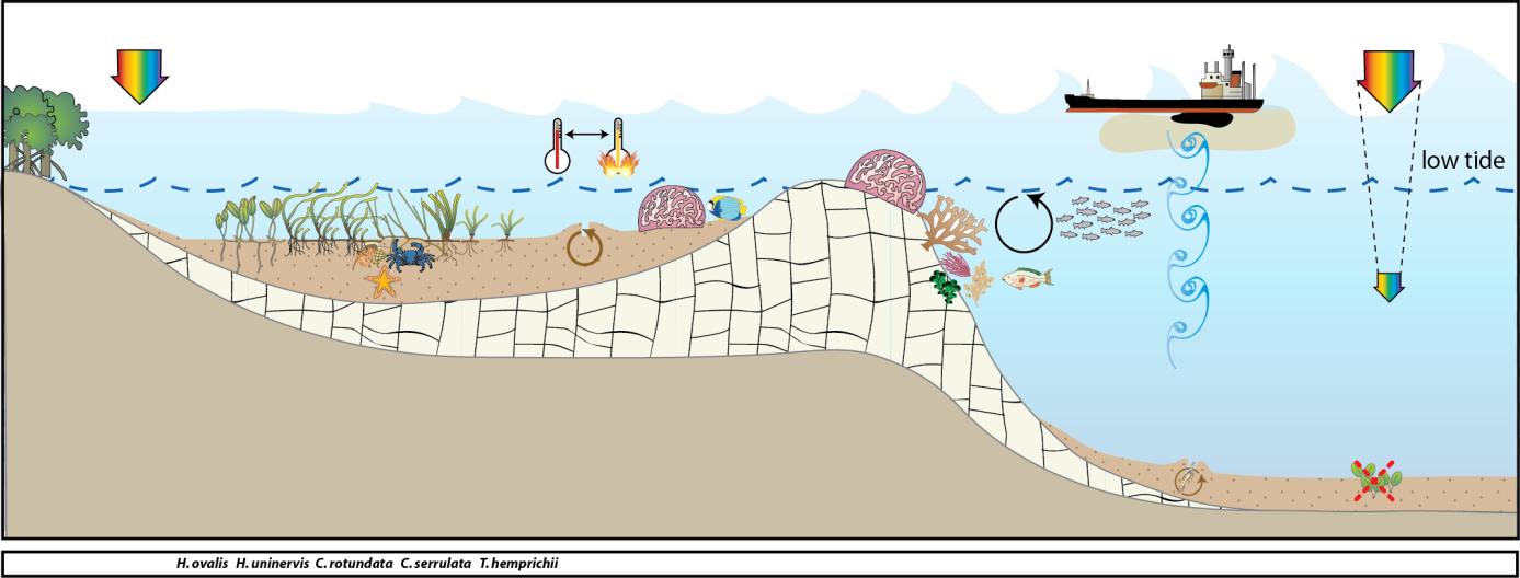
Conceptual diagrams of seagrass habitat in Cape York Region
Most inshore seagrass meadows in the Cape York region are within coastal habitats. The majority of these meadows are in the shallow subtidal waters of large bays sheltered from the prevailing trade winds. These seagrass meadows are also highly productive and provide important nursery grounds for fisheries (Coles, et al. 1987). The meadows are also of important to the large dugong population within the region (Marsh and R 2002). The coastal seagrass meadows at Bathurst Head and Shelburne Bay are located on naturally dynamic sand banks. These meadows are dominated by Halodule uninervis with some Halophila ovalis and are often exposed to regular periods of disturbance from wave action and consequent sediment movement. A dominant influence to these coastal meadows is exposure to wind/wave disturbance and terrigenous runoff from seasonal rains (Carruthers, et al. 2002).
Reef habitats in the Cape York region support diverse seagrass assemblages. Approximately 3% of all mapped seagrass meadows in the Cape York region are located on fringing-reefs (Coles, et al. 2007). In these environments, physical disturbance from waves and swell and associated sediment movement primarily control seagrass growth. Shallow unstable sediment, fluctuating temperature, and variable salinity also characterize these habitats. Sediment movement due to bioturbation and prevalent wave exposure creates an unstable environment where it is difficult for seagrass seedlings to establish or persist.
Marine Monitoring Program
2019 -2020 Summary
Seagrass meadow condition across the Cape York NRM region in 2019–20 declined slightly from 2018–19. The reduction was due to lower scores in the abundance score and continued low scores for the reproductive effort and nutrient status indicators. For the three indicators:
- abundance score was poor
- tissue nutrient score was poor
- reproductive effort score was very poor.
On average, seagrass abundance (per cent cover) reduced relative to the previous period. Seagrass abundance decreased at half of the Cape York sites, but only in coastal and subtidal habitats. The only increases occurred at intertidal reef meadows throughout the region.
Seagrass leaf tissue nutrient concentrations in 2019–20 were largely unchanged compared to previous years, remaining poor. The exception was at Bathurst Bay, where C:N declined and %N increased following above average river discharge in 2019.
There were no reproductive structures observed in Cape York in 2019–20 for the third time in the 15 year monitoring history and the decreased reproductive effort may weaken capacity to recover from seeds in the near future. However, there were persistent and/or increasing seed banks at intertidal coastal meadows, which could aid recovery in the short term, if environmental conditions are favourable for germination. The lack of seeds in most intertidal reef meadows currently limits recovery.
An assessment of long-term trends in other Cape York habitats is affected by changes in the number, onset and duration of monitoring at individual sites. Per cent cover progressively decreased at intertidal reef habitats across Cape York from 2003 to 2012, with signs of improvement since, particularly at Stanley Island. Coastal intertidal and subtidal habitats monitored since 2012 and 2015 respectively, declined over the last two years in all locations except Shelburne Bay in the north of Cape York. Similarly, meadow extent across the region has been relatively stable since 2012.
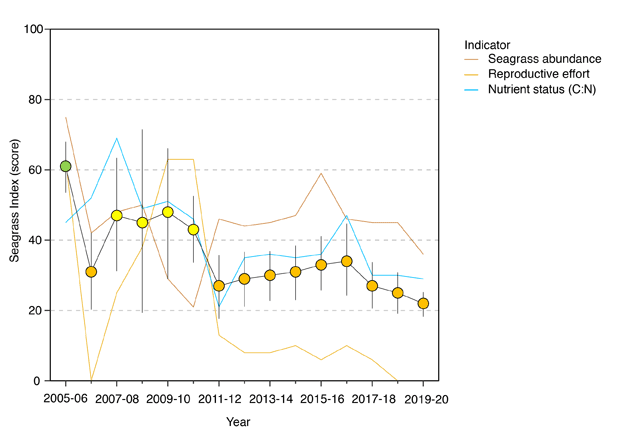
Seagrass condition index (±SE) with contributing indicator scores for the Cape York NRM region (averaged across habitats and sites).
Values are indexed scores scaled 0–100 and graded: ● = very good (81-100), ● = good (61 – 80), ● = moderate (41 – 60), ● = poor (21 – 40), ● = very poor (0 – 20). NB: Scores are unitless.
In the 2019–20 monitoring period, the seagrass condition index score for the Cape York region reduced slightly since the previous monitoring period, but the overall grade remained poor .
The greatest score reduction occurred in abundance, which declined from moderate in 2018–19 to poor in 2019–20. This is the first time a poor abundance score has been recorded since new sites were commissioned in 2012–13 and 2016–17.
The reproductive effort score was zero for the second year in a row and it is the first time that no reproductive structures were observed at any of the sites in the late dry sampling. Other counts with zero reproductive effort have been observed in the wet season but wet season data is not used in the metric, because it is a time that counts are typically low. Tissue nutrients remained poor and at the second lowest level recorded in Cape York.
Overall, the Cape York seagrass condition index remains well below the 2005–06 baseline and in 2019–20 was the lowest score since the addition of new sites in 2012–13.
An examination of the long-term trends across the Cape York NRM region needs to be interpreted carefully as new sites were included in 2012–13, which are associated with consistently lower abundance and tissue nutrients compared to the highest levels recorded for the region. Archer Point, which was the only location monitored prior to 2012–13, is now only monitored as part of the Seagrass-Watch due to logistical difficulties.
The reduction in seagrass abundance in 2019–20 is a consequence of reductions in per cent cover at coastal intertidal and subtidal sites at Bathurst Bay and reef subtidal sites in the Flinders Group). All of those sites are adjacent to the Normanby River mouth, which in the 2018–19 wet season, discharged at 2–3 times its annual median volume. Stanley island — within the same region — had more stable abundance. Seagrass abundance was either unchanged or slightly increased in the more northern regions of Cape York even though rivers discharged above the long-term median throughout the region and cyclones (TC Penny and Trevor) affected the region in the 2018–19 wet season.
An examination of the long-term trend in seagrass abundance shows seagrass per cent cover progressively decreased at intertidal reef habitats across Cape York from 2003 to 2012, with relatively little improvement (i.e. no trend) until 2019–20. Coastal intertidal and subtidal habitats which have only been monitored since 2012 and 2015 respectively, generally showed no trend until 2019–20, when abundance declined.
In 2019–20, the proportions of species displaying colonising species traits (largely Halophila ovalis) were similar to the previous reporting year in all habitats in the Cape York NRM region. With the exception of reef habitats, the proportions of colonising species were above GBR long-term averages for all other habitats in 2019–20. Reef subtidal habitats were exclusively colonising species.
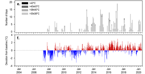
2019–20 was the eighth consecutive year intertidal within-canopy temperatures were above the long-term average. Maximum within-canopy temperatures exceeded 35°C for a total of 28 days (in total among all sites where temperature is monitored) during 2019–20, with the highest temperature recorded at 38.8°C (ST1, 2pm 18Feb20). Daily tidal exposure (hours water has drained from the meadow) was around the long‐term average for, which may have provided some respite from the elevated temperatures.
Long-term monitoring Results:
- Tropical cyclone Gretel affected the central region of Cape York in March 202021
- Rainfall was below the long-term average in Cape York in 2019–20, while river discharge was around the long-term average for the region as a whole. Discharge from the Olive–Pascoe and Lockhart Rivers in central Cape York, which likely influence Piper Reef and Shelburne Bay, were slightly above the long-term average, while other rivers were below it.
- The inshore waters of Cape York had predominantly secondary water type (‘green’, phytoplankton rich water), and some brown turbid water exposure through the wet season (December-April). Shelburne Bay sites (SR1 and SR2) had the highest exposure to turbid primary water, consistent with previous years, followed closely by Bathurst Bay intertidal sites (BY1 and BY2).
- The frequency of exposure to both primary and secondary water ranged from 57 per cent to 100 per cent of wet season weeks at seagrass monitoring sites, and was on average, higher than the long-term average due mostly to increased secondary ‘green’ water. The reasons for this are discussed in further detail in the water quality report (Waterhouse et al. 2021)21.
- Daily incident light (Id, mol m-2 d-1) reaching the top of the seagrass canopy is generally very high at all Cape York sites, largely because they are all intertidal (long‐term average = 16.4 mol m-2 d-1). However in 2019–20, daily incident light (15.9 mol m-2 d-1) was slightly below the long-term average. This was influenced primarily by the persistently low light levels at Bathurst Bay in 2019–20. However the shorter/incomplete logging duration (approximately half of data missing) at reef intertidal sites also contributed. Cape York sites are surveyed only once per year, and the instruments are not able to function for a full year due to battery life, and inevitable fouling.
Inshore seagrass and habitat condition 20:
- There are 17 seagrass monitoring sites in Cape York from 9 locations. Four seagrass habitat types were assessed across the Cape York region in 2019–20, with data from 14 of the 17 long-term monitoring sites.
- In the 2019–20 monitoring period, the seagrass condition index score for the Cape York region reduced slightly since the previous monitoring period, but the overall grade remained poor.
- The greatest score reduction occurred in abundance, which declined from moderate in 2018–19 to poor in 2019–20. This is the first time a poor abundance score has been recorded since new sites were commissioned in 2012–13 and 2016–17.
- The reproductive effort score was zero for the second year in a row and it is the first time that no reproductive structures were observed at any of the sites in the late dry sampling). Other counts with zero reproductive effort have been observed in the wet season but wet season data is not used in the metric, because it is a time that counts are typically low. Tissue nutrients remained poor and at the second lowest level recorded in Cape York.
- Overall, the Cape York seagrass condition index remains well below the 2005–06 baseline and in 2019–20 was the lowest score since the addition of new sites in 2012–13.
Seagrass abundance, composition and extent 20:
- The reduction in seagrass abundance in 2019–20 is a consequence of reductions in per cent cover at coastal intertidal and subtidal sites at Bathurst Bay and reef subtidal sites in the Flinders Group. All of those sites are adjacent to the Normanby River mouth, which in the 2018–19 wet season, discharged at 2–3 times its annual median volume. Stanley island — within the same region — had more stable abundance. Seagrass abundance was either unchanged or slightly increased in the more northern regions of Cape York even though rivers discharged above the long-term median throughout the region and cyclones (TC Penny and Trevor) affected the region in the 2018–19 wet season.
- An examination of the long-term trend in seagrass abundance shows seagrass per cent cover progressively decreased at intertidal reef habitats across Cape York from 2003 to 2012, with relatively little improvement (i.e. no trend) until 2019–20. Coastal intertidal and subtidal habitats which have only been monitored since 2012 and 2015 respectively, generally showed no trend until 2019–20, when abundance declined.
- In 2019–20, the proportions of species displaying colonising species traits (largely Halophila ovalis) were similar to the previous reporting year in all habitats in the Cape York NRM region. With the exception of reef habitats, the proportions of colonising species were above GBR long-term averages for all other habitats in 2019–20. Reef subtidal habitats were exclusively colonising species.
Seagrass reproductive status 20:
- Total reproductive effort is only monitored at intertidal meadows in Cape York. Reproductive effort declined at reef habitats in 2018–19, and remained low in 2019–20. Historically, from 2006 to 2012, reproductive effort in reef intertidal habitats was recorded only at Archer Point, which was decommissioned in 2018, and is now based on sites introduced in 2012, which have consistently low numbers of reproductive structures. Reproductive effort declined at coastal habitats across the region and were the lowest on record in 2018–19.
Epiphytes and macroalgae 20:
- Epiphyte cover on seagrass leaf blades at intertidal meadows remained below the long-term average at both coastal and reef habitats.
- Per cent cover of macroalgae was variable between locations.
- Macroalgae cover at coastal sites has varied little and this year remained near to the overall inshore Reef long-term average.
- At intertidal reef habitats, macroalgae cover remained above the Reef long-term average in the central and north of the region for the sixth consecutive year with macroalgae growing attached to coral rubble in the meadow, and not considered be at nuisance levels.
- Macroalgae at reef subtidal sites continued to remain below the overall inshore Reef long-term average.
Location
Archer Point
Monitoring: archived
Principal watchers: Mick Hale, Larissa Hale, Yuku-Baja-Muliku rangers, Christina Howley and Jason Carroll
Occasional and past watchers: John McLaren, Seagrass-Watch HQ
Location: On fringing reef flat in sheltered section of bay, bordered by mangroves, approximately 15km south of Cooktown.
Site code: AP1, AP2
Issues: land runoff
Comments: Popular recreational fishing area and turtle feeding grounds. Sites are dominated by Halodule uninervis and Halophila ovalis, with Cymodocea rotundata, Cymodocea serrulata, Enhalus acoroides, Thalassia hemprichii and Nanozostera.
The Yuku Baja Muliku people are the traditional custodians and owners of the land and sea country surrounding Archer Point on the eastern coast of Cape York Peninsula. The land borders the Wet Tropics rainforests and the Great Barrier Reef World Heritage Area, and includes the lower Annan River. The sea country covers 1,088 km2 and extends from Monkhouse Point in the north to Forsberg Point in the south (including Walsh and Walker Bays), and east to just past the Ribbon Reefs.
Fifteen species of seagrass are reported in the water of the Great Barrier Reef and twelve species are reported to occur within Yuku Baja Muliku sea country: Cymodocea serrulata, Cymodocea rotundata, Enhalus acoroides, Halodule uninervis, Halophila capricorni, Halophila decipiens, Halophila ovalis, Halophila spinulosa, Halophila tricostata, Syringodium isoetifolium, Thalassia hemprichii and nanozostera.
The highest species diversity of seagrass in the Yuku Baja Muliku sea country is found on the fringing reef immediately south of Archer Point and in the waters of Walker Bay.
Most species in the region are classified as colonising or opportunistic, capable of rapid recovery from losses due to fast asexual growth rates and capacity for generating large seed banks. Only seagrass of the genus Halophila are found in waters deeper than 15m. No seagrass species are listed as Endangered, Vulnerable, Near Threatened or Data Deficient under the IUCN Red List criteria
STATUS (2017)
- Long-term monitoring sites last assessed on 04 September 2017
- Seagrass cover long-term average was between 16% in winter (Dry) and 19% in the late Dry season.
- Seagrass cover at AP1 has generally followed a seasonal trend with higher abundance in late spring/early summer. However, no seasonal trend is apparent at AP2.
- Meadow abundance fluctuates between years, however, seagrass abundance over the long-term has significantly declined at AP1, but no trend is apparent at AP2.
- The sites are dominated by Halodule uninervis, Halophila ovalis and Cymodocea rotundata. AP2 has slightly more Cymodocea and Thalassia present.
- Species composition has varied since sampling began in 2003 with the composition of Halophila ovalis increasing in 2006/07; coinciding with significant losses in abundance. Since then, the composition of Halophila ovalis has fluctuated seasonally with increases in the late monsoon following physical disturbance (eg sediment movement) followed by deceases when the foundation species (Halodule and Cymodocea) increase.
Seagrass cover, species composition and canopy height
Timeseries of seagrass cover. Mean and standard error of site level observations shown. Timing of impacts attributed to acute disturbance events (Tropical cyclones) are indicated by vertical lines and disturbance symbol ֎ .
Seagrass Composition: Mean composition of each seagrass species during each sampling event.
Plots are interactive with mouse-over features providing additional detail.
Location
Shelburne Bay
Monitoring: ongoing, annual
Principal watchers: JCU, Seagrass-Watch HQ and Wuthathi Rangers
Location:on the large naturally dynamic intertidal sand banks in the south of the bay
Site code: SR1, SR2
Issues: There are no current land use activities occurring in this catchment.
Comments:Extensive Halophila ovalis, Halodule uninervis and Thalassia hemprichii dominated meadow. Dugong feeding trails common.
The Wuthathi people are the traditional custodians and owners of Wuthathi land and sea country surrounding Shelburne Bay on the north eastern coast of Cape York Peninsula.
Shelburne Bay has a limited catchment with two main rivers being the Harmer and Macmillian Rivers and a number of other smaller creeks and tributaries. The catchment contains one of the least disturbed parabolic sand dunes areas in the world and is made up of seasonal wetlands and sand ridges.
It has been estimated from mapping surveys over the last three and a half decades that there is as much as 76.9 km2 of seagrass in the Wuthathi Sea Country waters shallower than 15m. There is at least an additional 33.6 km2 of meadows in the Wuthathi Sea Country waters deeper than 15m. The intertidal monitoring sites at Shelburne Bay are approximately 5 km west of the mouth of the Harmer River.
STATUS
- Long-term monitoring sites last assessed on 04 September 2017
- Seagrass cover long-term average was between 16% in winter (Dry) and 19% in the late Dry season.
- Seagrass cover at AP1 has generally followed a seasonal trend with higher abundance in late spring/early summer. However, no seasonal trend is apparent at AP2.
- Meadow abundance fluctuates between years, however, seagrass abundance over the long-term has significantly declined at AP1, but no trend is apparent at AP2.
- The sites are dominated by Halodule uninervis, Halophila ovalis and Cymodocea rotundata. AP2 has slightly more Cymodocea and Thalassia present.
- Species composition has varied since sampling began in 2003 with the composition of Halophila ovalis increasing in 2006/07; coinciding with significant losses in abundance. Since then, the composition of Halophila ovalis has fluctuated seasonally with increases in the late monsoon following physical disturbance (eg sediment movement) followed by deceases when the foundation species (Halodule and Cymodocea) increase.
Seagrass cover, species composition and canopy height
Timeseries of seagrass cover. Mean and standard error of site level observations shown. Timing of impacts attributed to acute disturbance events (Tropical cyclones) are indicated by vertical lines and disturbance symbol ֎ .
Seagrass Composition: Mean composition of each seagrass species during each sampling event.
Plots are interactive with mouse-over features providing additional detail.
Location
Margaret Bay (Cape Grenville)
Monitoring: ongoing, annual
Principal watchers: QPWS
Location: Cape York
Site code: MA1, MA2
SITE ESTABLISHED NOVEMBER 2021
Seagrass cover, species composition and canopy height
Timeseries of seagrass cover. Mean and standard error of site level observations shown. Timing of impacts attributed to acute disturbance events (Tropical cyclones) are indicated by vertical lines and disturbance symbol ֎ .
Seagrass Composition: Mean composition of each seagrass species during each sampling event.
Plots are interactive with mouse-over features providing additional detail.
Location
Piper Reef (Farmer/Fisher Island)
Monitoring: ongoing, annual
Principal watchers: JCU, Seagrass-Watch HQ
Location: reef platform shared with Farmer and Fisher Islands, which form part of the Piper Islands National Park (CYPAL) (declared in 1989), jointly managed with Kuuku Ya’u Traditional Owners.
Site code: FR1, FR2
Issues: Minor land use activities, with some small level housing on the Pascoe River at the Wattle Hills settlement.
Comments: It is influenced by coastal waters from the Olive and Pascoe Rivers along with the Temple Bay catchment. Three seagrass species present: Thalassia hemprichii, Cymodocea rotundata and Halophila ovalis
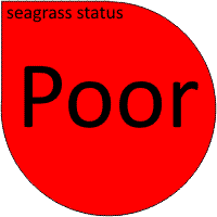
STATUS
- Seagrass abundance declined in 2021 to a Poor state, after remaining relatively stable in a Fair state over the previous seven years. No significant long-term trend (increase or decrease) is apparent
- Sites are dominated by Thalassia hemprichii (including minor amounts of Cymodocea spp. and Halophila ovalis), with little change between years
- Seagrass canopy height (Thalassia hemprichii leaf length) is similar at both sites and correlated with abundance
- Macroalgal and epiphyte abundance is generally low, with little change between years
- seagrass abundance has fluctuated at both Piper Reef sites since monitoring was established.
Seagrass cover, species composition and canopy height
Timeseries of seagrass cover. Mean and standard error of site level observations shown. Timing of impacts attributed to acute disturbance events (Tropical cyclones) are indicated by vertical lines and disturbance symbol ֎ .
Seagrass Composition: Mean composition of each seagrass species during each sampling event.
Plots are interactive with mouse-over features providing additional detail.
Location
Yum Yum
Monitoring: suspended
Principal watchers: Northern Kuuku Ya’u Land and Sea Rangers, Seagrass-Watch HQ,
Location: on the intertidal fringing reef flat
Site code: YY1
Seagrass cover, species composition and canopy height
Timeseries of seagrass cover. Mean and standard error of site level observations shown. Timing of impacts attributed to acute disturbance events (Tropical cyclones) are indicated by vertical lines and disturbance symbol ֎ .
Seagrass Composition: Mean composition of each seagrass species during each sampling event.
Plots are interactive with mouse-over features providing additional detail.
Location
Lloyd Bay, Lockhart River
Monitoring: ongoing, annual
Principal watchers: QPWS
Location: coastal subtidal meadows
Site code: LR1, LR2
STATUS
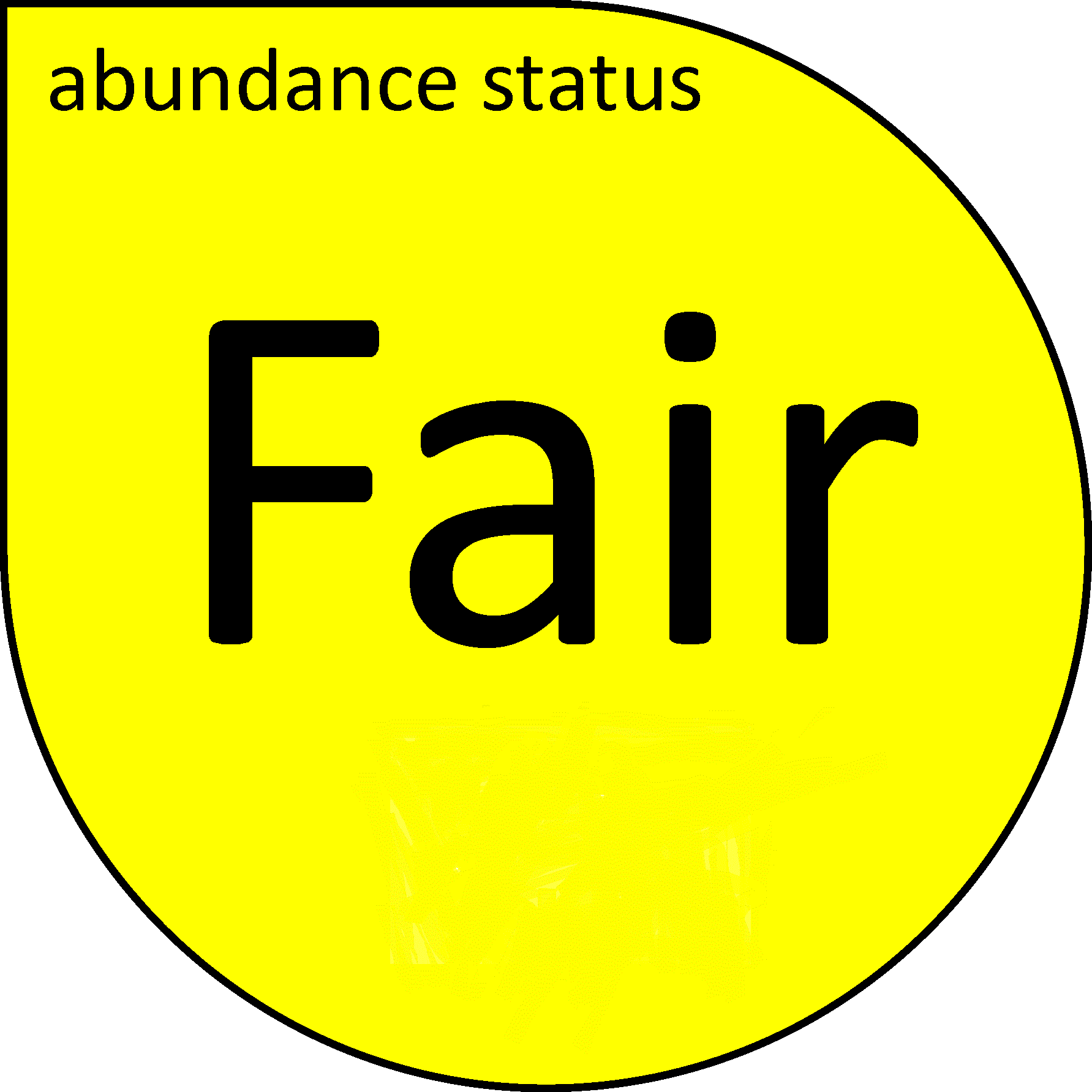
- Seagrass abundance increased at one site but decreased at the other in 2021 but remains in a Fair state overall. There is no apparent trend in seagrass abundance over the long-term.
- Sites are dominated by Thalassia hemprichii (including minor amounts of Cymodocea spp. and Halophila ovalis), with little change between years
- Seagrass canopy height (Thalassia hemprichii leaf length) is similar at both sites and correlated with abundance
- Macroalgal and epiphyte abundance is generally low, with little change between years.
Seagrass cover, species composition and Macroalgae cover
Timeseries of seagrass cover. Mean and standard error of site level observations shown. Timing of impacts attributed to acute disturbance events (Tropical cyclones) are indicated by vertical lines and disturbance symbol ֎ . Lower case "s" after site code, denotes subtidal sites.
Seagrass Composition: Mean composition of each seagrass species during each sampling event.
Plots are interactive with mouse-over features providing additional detail.
Location
Stanley Island
Monitoring: ongoing
Principal watchers: JCU, Seagrass-Watch HQ
Location: Stanley Island is within the Flinders Island group north of Bathurst Bay. The sites are located on an intertidal fringing reef flat fringed with mangroves.
Site code: ST1, ST2

Comments: The Flinders Island group are influenced by the Princess Charlotte Bay catchment which has four river systems, the Normanby, Marrett, Bizant and North Kennedy Rivers.
STATUS
- Seagrass abundance declined in 2021 but remained in a Fair state. Abundance has significantly increased over the long-term.
- Sites are dominated by Thalassia hemprichii (including minor amounts of Cymodocea spp. and Halophila ovalis), with little change between years
- Seagrass canopy height (Thalassia hemprichii leaf length) is similar at both sites and correlated with abundance
- Macroalgal and epiphyte abundance is generally low, with little change between years.
Seagrass cover, species composition and canopy height
Timeseries of seagrass cover. Mean and standard error of site level observations shown. Timing of impacts attributed to acute disturbance events (Tropical cyclones) are indicated by vertical lines and disturbance symbol ֎ .
Seagrass Composition: Mean composition of each seagrass species during each sampling event.
Plots are interactive with mouse-over features providing additional detail.
Location
Flinders Group
Monitoring: ongoing
Principal watchers: QPWS
Location: reef subtidal meadows
Site code: FG1, FG2
STATUS
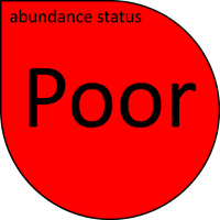
- Seagrass abundance has continued to decline since 2018 and was in a Poor state in 2021. No long-term trend in abundance is apparent.
- Sites are dominated by Thalassia hemprichii (including minor amounts of Cymodocea spp. and Halophila ovalis), with little change between years
- Seagrass canopy height (Thalassia hemprichii leaf length) is similar at both sites and correlated with abundance
- Macroalgal and epiphyte abundance is generally low, with little change between years.
Seagrass cover, species composition and canopy height
Timeseries of seagrass cover. Mean and standard error of site level observations shown. Timing of impacts attributed to acute disturbance events (Tropical cyclones) are indicated by vertical lines and disturbance symbol ֎ .
Seagrass Composition: Mean composition of each seagrass species during each sampling event.
Plots are interactive with mouse-over features providing additional detail.
Location
Bathurst Bay
Monitoring: ongoing
Principal watchers: JCU, Seagrass-Watch HQ, QPWS
Location: adjacent to Princess Charlotte Bay, a coastal location fringed by mangroves on the eastern edge of the bay.
Site code: BY1, BY2, BY3 (subtidal), BY4 (subtidal)
Issues: The catchment area covers 24,228 km2 and consists of one of Queensland’s largest conservation areas, extensive cattle grazing country (75% of the catchment), and rich agricultural land at Lakeland Downs
Comments: The sites are within 20km of the mouths of the Normanby and Margaret Rivers. The Normanby River is the fourth largest river system flowing into the Great Barrier Reef. Five seagrass species present : Halodule uninervis, Halophila ovalis, Thalassia hemprichii, Cymodocea rotundata and Syringodium isoetifolium
STATUS
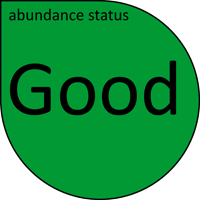
- Seagrass abundances in both intertidal and subtidal meadows have recovered to a Good state in 2021, after the losses experienced in early 2019. No long-term trend in abundance is apparent.
- Sites are dominated by Thalassia hemprichii (including minor amounts of Cymodocea spp. and Halophila ovalis), with little change between years
- Seagrass canopy height (Thalassia hemprichii leaf length) is similar at both sites and correlated with abundance
- Macroalgal and epiphyte abundance is generally low, with little change between years.
Seagrass cover, species composition and canopy height
Timeseries of seagrass cover. Mean and standard error of site level observations shown. Timing of impacts attributed to acute disturbance events (Tropical cyclones) are indicated by vertical lines and disturbance symbol ֎ . Lower case "s" after site code, denotes subtidal sites.
Seagrass Composition: Mean composition of each seagrass species during each sampling event.
Plots are interactive with mouse-over features providing additional detail.
Location
Napranum
Monitoring: suspended
Principal watchers: Jerry Wapau, Richard Barkley, Christina Howley and Seagrass-Watch HQ
Location: Eastern bank of the Embley River, Albatross Bay, south Weipa.
Site code: NP1
Issues: Port development and land runoff
Comments: Napranum is within Albatross Bay and includes the township of Weipa. Albatross Bay catchment is fed by the Mission, Hey, Pine and Embley Rivers and Nomenade Creek. The catchment has high biological diversity and comprises extensive wetlands, coastal dunes, sedge land, saltpans and mangrove areas bordered by areas of vine, gallery and eucalypt forest on the bauxite plateaux. The coastal area and catchments in Albatross Bay have been identified as wetlands of national conservation significance. The region contains extensive and diverse seagrass communities that provide habitat for juvenile fish and prawn species important to commercial, recreational and local community subsistence fisheries and food for dugong and turtle. Many of these meadows are found near port facilities and shipping activity.
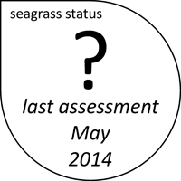
STATUS (May 2014)
- Mean seagrass cover is generally 10 – 40%. Abundance in early 2010 was the highest since monitoring was established, however declined in 2011 to 2007 level.
- Seagrass abundance appears seasonal, with higher abundances earlier in the year. Between April and September, the seagrass abundance changed by up to 50%.
- Epiphytes are significantly higher early in the year (>80%).
- Algae cover generally low.
- Site is predominately mud/sand with some gravel. No changes in sediment composition over monitoring period.
- Regional climate appears the most likely driver of observed changes.
- Sites predominately Halodule uninervis with Halophila ovalis and Thalassia hemprichii. Patches of Enhalus acoroides are in the vicinity, but rarely within the monitoring site
Seagrass cover, species composition and canopy height
Location
Port Musgrave
Monitoring: ongoing, ad hoc
Principal watchers: Seagrass-Watch HQ, Nicholas Woodley, Cecil Woodley, Lawry Booth, Lana Polglase, and Craig Wheeler
Location: north-eastern bank of Cullen Point, within Port Musgrave
Site code: CP1, CP2

Issues: Port development and land runoff
Comments: Port Musgrave is a shallow, almost enclosed, estuary, forming a bay on the western coast of the Cape York Peninsula. Two major rivers, the Wenlock and the Ducie, to the north and south respectively, discharge into it. The surrounding area is rich in freshwater swamps, while the estuary itself has extensive tidal flats and mangroves. The small community of Mapoon (~200 pp) lies on the southern shore of the bay.
STATUS
- Mean seagrass cover is generally 12 – 35%, and abundances between years similar. Last assessment was 17 June 2019, when seagrass abundance was in a Poor state.
- Seagrass abundance appears seasonal, with higher abundances earlier in the year, however dataset is limited.
- Sites are predominately sand with some mud content.
- Due to the paucity of data, no long term trends are apparent