timor-leste
IKI Seagrass Ecosystem Services Project
Mapping Results
some cool facts
Some field facts
Some
field facts

How to use map viewer
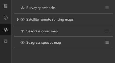 In Map Viewer, on the Contents (dark) toolbar (found on the left), select
 ![]() (Layers) to display all the different map Layers.
(Layers) to display all the different map Layers.
The legend ![]() displays information about each layer that is visible at the current map scale. Not all layers contain legend information.
displays information about each layer that is visible at the current map scale. Not all layers contain legend information.
On the Contents (dark) toolbar, click (Legend). The legend displays information about each layer that is visible at the current map scale. Not all layers contain legend information.
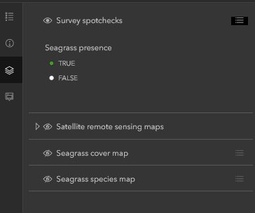 You do not need to show all map layers in the legend. For example, if the map focuses on seagrass distribution and extent for a region/country, you may want the legend to show only spotcheck symbols and not seagrass species and other reference data included in the map.
To hide a layer in the legend, do the following:
- Open the map with the legend in which you want to hide a layer.
- On the Contents (dark) toolbar, click Layers
 .
. - Browse to the layer you want to hide (turn off) or show (turn on).
- The layer visibility can then be turned on (Show layer
 ) or off (Hide layer
  ) by clicking the eye symbol on the list.
Using the mouse wheel makes it easy to zoom and pan anytime you like without changing the tool you are currently using.
These shortcuts work in data view and layout view. In layout view, they apply to the page by default. You can hold down the SHIFT key and perform any shortcut to apply it to the data frame instead of the page (the active data frame in the case of rolling the mouse wheel, or the data frame you clicked in the case of clicking or dragging the mouse wheel).
| Mouse wheel action | ArcMap navigation function |
|---|---|
| Rolling wheel back and forth | Zooms in and out |
| Holding down CTRL and rolling | Zooms in and out but with finer increment; used for small adjustments |
| Clicking mouse wheel (or middle mouse button) | Centers map at location where you clicked |
| Holding down mouse wheel (or middle mouse button) and dragging | Pans |
| Holding down CTRL and clicking mouse wheel | Centers and zooms in at location you clicked |
| Holding down CTRL and dragging with the mouse wheel | Zooms in |
Hera Seagrass mapping results
Timor-Leste

Partner: Blue Ventures
Field Mapping: completed
Data Management: completed
QAQC/analysis: completed
Map Creation/Reporting: completed
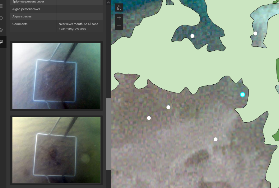
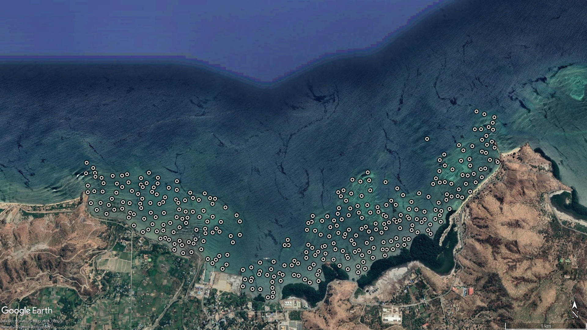
Seagrass meadows within the bay at Hera, northern Timor-Leste, were assessed between the 30 November 2022 and 08 March 2023. Observers walked or used drop-cameras to collect photoquadrats at mapping points, which were positioned using a restricted random sampling design. Visual estimates of above-ground seagrass percent cover, seagrass species and macroalgae percent cover were recorded at each mapping point from 3 quadrats (50cm x50cm), using globally standardised Seagrass-Watch protocols. Substrate type was assessed at each mapping point by hand, and aided by a Van Veen grab at subtidal points. A differential handheld global positioning system (GPS) was used to locate each mapping point (accuracy ±3m).
A total of 358 individual points were examined, of which 214 were collected in situ and 83 from Seagrass Spotter. Seagrass was present at 260 of the mapping points, with percentage cover ranging from 0.7 to 100%, and with an average of 36.8%. Ten seagrass species were identified, with the most frequently encountered being Enhalus acoroides, Thalassia hemprichii and Halodule uninervis (39.6%, 23.6% and 10.1%average cover, respectively).
Spatially explicit seagrass maps were created from PlanetScope Dove (3.7 m × 3.7 m pixel) imagery, using the field validation point data and a machine-learning model (random forest). A total of 130.92 to 247.68 hectares of seagrass meadows was mapped within Hera bay. Two main seagrass areas were identified.
- The first area to the west covered up to 62 ha and was composed of a mosaic of meadow communities mainly dominated by Halodule uninervis or Thalassia hemprichii, with smaller sections dominated by Halophila ovalis and Syringodium isoetifolium.
- The second main seagrass area was to the east and was much larger, covering up to 173 ha. This larger area was also a mosaic of meadow communities, but mainly dominated by Enhalus acoroides or Thalassia hemprichii, with smaller scattered sections dominated by Halophila ovalis, Halodule pinifolia, Cymodocea rotundata or Syringodium isoetifolium. The outer sections of the seagrass, toward the reef crest, were often dominated by Thalassodendron ciliatum.
How the data was collected
Field validation points were spatially balanced and randomised within the Area of Interest (AOI). All data collected within the AOI was used to ensure mapping of all seagrass meadows present.
At each field validation point, teams conducted a spot-check using either Drop-Cam, in situ observation, or grab.
Photoquadrats were captured (except where only a grab sampler was used) during each spot-check. Photoquadrats were either geotagged or geolocated. Data collected from the photoquadrats (e.g. % cover and species) at each point and the Seagrass Spotter sightings were used to train and validate models for classification of satellite imagery.
Timor-Leste seagrass
Seagrass conservation efforts in Timor-Leste have been impeded by substantial knowledge gaps. In 2007, the first broad-scale mapping of nearshore habitats in Timor-Leste took place along the northern coast. The results estimated the overall area of seagrass habitat in the area to be approximately 4,266 ha.
Research by WorldFish in 2020, showed that many women in local communities rely upon the practice of reef gleaning – the collection of intertidal marine resources (e.g., juvenile fishes, crabs, mollusks, and sea urchins) by hand or hand tool – as a source of reliable food in places where shallow reefs, seagrass and mangroves are close to shore.
Partnership

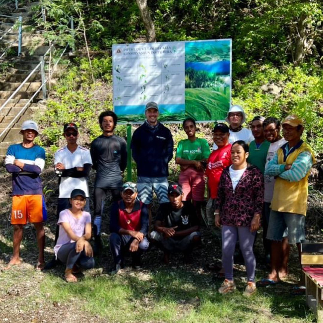
Working with Blue Ventures Timor-Leste (with in-field assistance from Project Seagrass), Seagrass-Watch in partnership with IKI, CMS aimed to collate rich but dispersed seagrass distribution information into an easily searchable, viewable and fully customisable map-based view for seagrass meadows of Hera (Timor-Leste)
This project is part of the International Climate Initiative (IKI). The Federal Ministry for the Environment, Nature Conservation and Nuclear Safety (BMU) supports this initiative on the basis of a decision adopted by the German Bundestag.

